The existing 151-foot clearance of the Bayonne Bridge is a limitation to future post-Panamax vessels following the anticipated completion of the Panama Canal expansion. In late 2010, The Port Authority of NY & NJ approved $1.3 billion dollars and initiated the planning, environmental regulatory review, preliminary engineering and final design of the “Raise the Roadway” alternative to achieve a 215-foot navigational clearance.
On Tuesday, April 7, 2015 Joann Papageorgis, Program Director of The Bayonne Bridge Navigational Clearance Program, will present an overview of the innovative approach to advance rehabilitation and redesign of the historic Bayonne Bridge, in lieu of other bridge replacement alternatives. It will begin at 5:00 p.m. in the Special Events Forum, Civic Square Building, 33 Livingston Avenue, New Brunswick, NJ on the campus of Rutgers University.
The presentation will highlight construction means and methods as ways to minimize environmental and community impacts; eliminate private right-of way acquisition; keep the roadway open during construction; limit impacts in the navigational channel, preserve the historic, iconic arch; remove the original (1931) lead-based paint; expedite the construction schedule; and minimize cost. Animation and video clips will illustrate the innovative design, construction staging, and community mitigation that was implemented to advance this critical regional infrastructure project, which is approximately 30 percent complete.
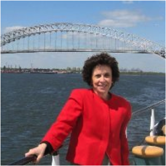 Ms. Papageorgis is responsible for expediting the planning, environmental and regulatory review, preliminary and final engineering, permitting, contract award, and construction of the Bayonne Bridge “Raise the Roadway” Project. Previous Port Authority management positions included management and forecasting of $1 Billion in annual tunnel and bridge toll revenues and introduction of the first congestion pricing (time of day) toll policy in 2001. Prior to joining the Port Authority in 1985, Ms. Papageorgis worked several years in the private sector for an international consulting and engineering firm, after receipt of her Masters in City and Regional Planning (MCRP) from Rutgers University.
This event is cosponsored by the Alan M. Voorhees Transportation Center at the Edward J. Bloustein School of Planning and Public Policy, and the Center for Advanced Infrastructure and Transportation, Rutgers, The State University of New Jersey along with the North Jersey Transportation Planning Authority and the Port Authority of NY & NJ. The event is free and open to the public. Registration is requested by visiting http://bit.ly/vtc-bayonnebridge.